

Detailed Description
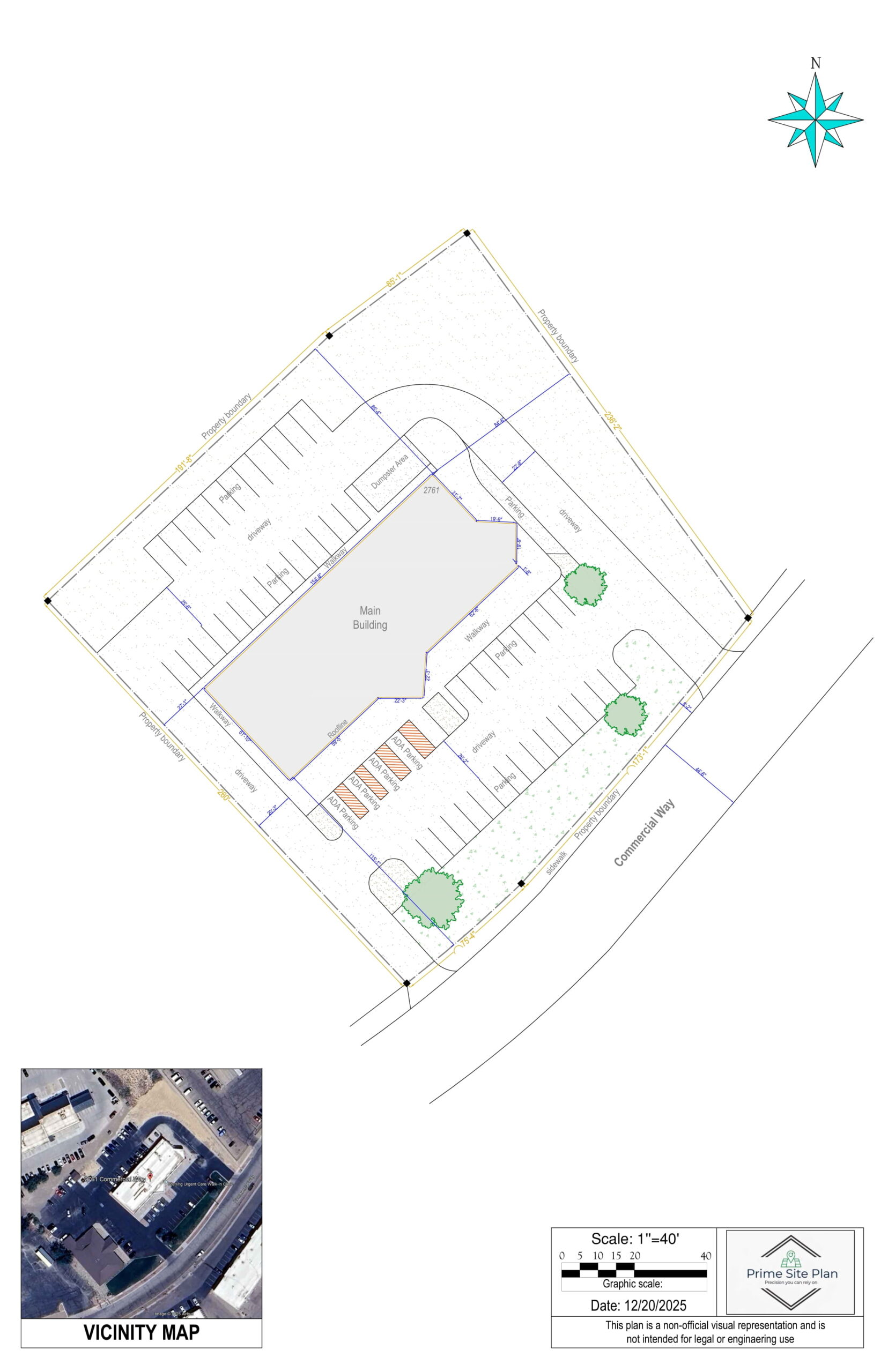
Our Commercial Site Plan provides a comprehensive representation of commercial and mixed-use properties for permitting, planning, and development purposes. This plan includes property boundaries, all visible structures, lot dimensions, parcel information, address, scale, and north arrow.
The plan also includes parking lots, driveways, access routes, sidewalks, landscaping features, visible terrain elements, and other significant site improvements. Enhanced measurements are provided between key site components to support project planning and coordination.
Utility locations, easements, and other available site information can be incorporated when provided by the client.
Ideal For
- Commercial permit applications
- Tenant improvement (TI) projects
- Parking lot modifications and expansions
- Site redevelopment projects
- Commercial property planning
- Contractor and architect coordination
- Zoning and planning reviews
- Pre-construction feasibility assessments
Reviews
There are no reviews yet.